Navigating Calgary's Winter Roads: Tips by Neighbourhood
In this article
- Why Neighbourhood Matters More Than You Think
- Southwest Quadrant: The Hills Are Not Your Friend
- Best Routes During Southwest Storms
- Northwest Quadrant: Long Distances, Wind, and Ravine Crossings
- Panorama Hills Egress Planning
- Northeast Quadrant: Flat, Fast, and Windswept
- Downtown Calgary: A Different Kind of Winter Challenge
- Driving to Downtown From the Suburbs
- Airdrie: Wind, Flat, and Highway 2 Exposure
- School Zones and Playground Zones in Winter
- Vehicle Choice Should Match Your Specific Neighbourhood
- How Calgary's Plowing Priority Affects Your Neighbourhood
- The Chinook Effect: Calgary's Unique Winter Weather Variable
- Tire Maintenance: The Non-Negotiable
- Block Heaters and Cold-Start Prep by Neighbourhood Parking Type
- Getting Into a Winter-Ready Vehicle
- Related Buyer Guides
- Compare and Apply
Check Your Options in 3 Minutes
No credit impact. All credit situations welcome.
★★★★★ 89+ Google Reviews · AMVIC Licensed · Free Delivery 300km
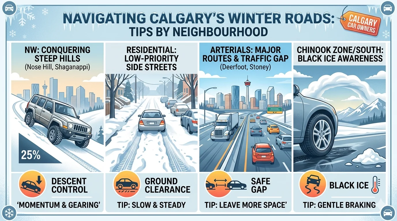
Ask any Calgarian who's white-knuckled their way down a hill in Signal Hill during a January chinook melt and you'll hear the same thing: not all winter driving in this city is created equal. The neighbourhood you live in shapes your risk profile more than almost any other factor — and yet most winter driving advice treats Calgary like a flat, uniform grid. It isn't. From the steep ravine roads of the southwest to the wind-scoured flats of Airdrie, your commute has its own specific hazards, and your vehicle should match them.
See what you pre-qualify for
Three quick answers — soft check, no commitment.
Why Neighbourhood Matters More Than You Think
Calgary's terrain is wildly varied for a prairie city. The Bow River cuts deep valleys through the southwest. The escarpment that runs from Signal Hill to Edgemont drops dramatically. The northeast and north are largely flat, but exposed to open prairie winds that can pile snow and reduce visibility to near zero in minutes. A rear-wheel-drive sedan that handles perfectly on a flat Airdrie street can be a liability on a 15-percent hill in Tuscany.
Then there's the plowing question. The City of Calgary prioritizes arterials and emergency routes first, then collector roads, then residential streets. A neighbourhood like Panorama Hills — which has limited egress points via steep collector roads — can trap residents for hours after a storm while the main roads are already clear. Understanding your neighbourhood's road priority tier is as important as understanding its terrain.
And there's the chinook factor: no other major Canadian city experiences the temperature swings Calgary does. A road that was icy at 7 AM can be wet by noon and then re-freeze by 6 PM as the chinook dies. That freeze-thaw cycle creates the notorious black ice that catches even experienced drivers off guard.
Southwest Quadrant: The Hills Are Not Your Friend
Signal Hill, Tuscany, Cougar Ridge, Aspen Woods, and the other southwest communities built on Calgary's escarpment have some of the most challenging winter roads in the city. The terrain is the issue: roads that run relatively north-south cross the escarpment via collector streets that drop steeply, and during icy conditions, those drops are unforgiving.
The Tuscany Ravine road is notorious. Strathcona Drive in Signal Hill catches drivers every year. The Cougar Ridge access points via 85th Street SW can turn glassy in minutes after a temperature drop. These aren't roads where winter tires alone are sufficient — they're roads where all-wheel drive becomes a legitimate safety consideration.
Key point: AWD gives you traction on acceleration, which is helpful getting up a hill. But it does nothing for you going down. Winter tires — specifically the studdable variety for steep residential streets — are what matter when you're descending. The combination of AWD plus winter tires is the gold standard for southwest Calgary residents.
For residents of these communities, vehicle choice genuinely matters. A compact front-wheel-drive car with quality winter tires will handle most situations, but families doing daily school runs on steep residential streets should seriously consider an AWD option. The Subaru Outback with its symmetrical AWD and good ground clearance is a perennial favourite in these neighbourhoods, as is the Toyota RAV4 with its available AWD and strong reliability record. If you're comparing your options before buying, our guide to AWD vs 4WD in Alberta breaks down which system actually suits Calgary's conditions.
Best Routes During Southwest Storms
When conditions deteriorate, experienced southwest residents know to avoid the obvious escarpment crossings. Sarcee Trail is usually plowed more aggressively than residential connectors. Stoney Trail (the ring road) stays clearer than most arterials because its traffic volume generates heat and its median trees break wind. If you're heading downtown, Glenmore Trail or Crowchild Trail are better bets than residential shortcuts once those routes are in poor condition.
Northwest Quadrant: Long Distances, Wind, and Ravine Crossings
Coventry Hills, Panorama Hills, Evanston, Kincora, Nolan Hill — the northwest has expanded dramatically in the last decade and brings its own winter challenges. Panorama Hills in particular is built on a ridge, and its collector roads drop sharply on both the east and west sides. Country Hills Boulevard, which is the main arterial serving this area, gets plowed early but its on/off traffic patterns mean ice can form in shaded sections near the underpasses.
The northwest also sits in a wind corridor. When a cold Alberta clipper comes through, these communities face blowing and drifting snow that can reduce visibility significantly even after the snowfall has stopped. Vehicles with higher ground clearance handle the unplowed residential streets better — a sedan that bottoms out in a 20-centimetre drift can leave you stuck a block from home.
Coventry Hills residents have the advantage of relatively flat terrain but face the Deerfoot Trail interchange, which is notorious for wind-driven ice formation on the overpass sections. If you commute south on Deerfoot during winter, that interchange deserves specific attention — ease off the throttle before you hit the overpass, not on it.
Panorama Hills Egress Planning
One of the practical realities of Panorama Hills is that there are limited ways out. Country Hills Boulevard is the primary artery, and if it's closed or seriously compromised, options are thin. Residents here benefit from building extra departure time into their morning commute and checking 511 Alberta before heading out on storm days. Having a vehicle that can handle an unplowed residential street to reach the cleared arterial is important — this is another scenario where AWD earns its keep.
Northeast Quadrant: Flat, Fast, and Windswept
Saddle Ridge, Taradale, Martindale, Saddletowne — the NE is Calgary's flattest quadrant and in some ways its most exposed. The terrain won't put you in a ditch on a steep hill, but the wind exposure is severe. Open prairie to the north and east means there's nothing to break the wind, and when a blizzard hits the northeast, visibility drops fast. Whiteout conditions on Stoney Trail in the northeast happen multiple times each winter.
Saddle Ridge and the surrounding communities have grown so rapidly that road infrastructure sometimes lags behind population. Newer residential streets may not have the same plowing priority as established areas, meaning you'll encounter unplowed streets more often. Ground clearance matters here too, and for families needing cargo space and capability, an Explorer or Honda Pilot offers the combination of room and all-weather capability that suits large northeast families.
The NE is also home to Calgary's industrial and warehouse districts, meaning significant heavy truck traffic on Metis Trail, McKnight Boulevard, and Deerfoot Trail. Heavy trucks cannot stop quickly on ice. Maintaining greater following distances than you think you need when driving near semis in the northeast during winter is genuine safety advice, not just platitude.
Downtown Calgary: A Different Kind of Winter Challenge
Downtown winter driving is less about terrain and more about infrastructure. Narrow streets between tall buildings create wind tunnels and deep shade — shaded streets in the financial core can stay icy for days after a storm while nearby sunny streets are clear. The Plus 15 walkway system means significant pedestrian traffic that doesn't always look before crossing, and those pedestrians are unpredictable in winter weather.
Parkade access and the ramps into underground parking create ice hazards of their own. Ramps that face north stay frozen far longer than south-facing ones. The approach to Palomino Parkade on 8th Avenue, the ramp at Eau Claire Market, the parkade exits on 3rd Street SW — these spots catch drivers who are already relaxing because they've made it to the core.
Street parking downtown is complicated by plugged-in parking: in extreme cold (below -20°C), you need to be able to plug your block heater in. Downtown has some powered parkades and street meters with power, but they're not universal. Knowing where you'll park in advance — and whether it has power — matters on a -30°C morning.
Driving to Downtown From the Suburbs
The Deerfoot Trail is Calgary's main north-south artery and it carries a specific set of winter risks: high speeds, significant truck traffic, and a long exposed stretch that generates ice particularly on the overpass sections. If you're commuting from the north end (Airdrie, Crossfield, or anywhere on Highway 2) into downtown, Deerfoot is typically your fastest route but not always your safest in a storm. Barlow Trail or Centre Street are slower but more forgiving.
Airdrie: Wind, Flat, and Highway 2 Exposure
Residents of Airdrie live in a beautiful small city, but winter brings specific challenges that differ from Calgary's. The terrain is flat — no Signal Hill descents — but the wind exposure is intense. Airdrie sits on open prairie with nothing between it and the north, and when Alberta's cold air masses push south, Airdrie gets the first blast. Blowing snow can drift across roads quickly, especially on the newer streets in communities like Kings Heights and Windsong that don't yet have mature tree cover for wind breaks.
Highway 2 between Airdrie and Calgary is one of the most treacherous winter routes in the province. The section between the Balzac interchange and McKnight Boulevard sees multiple collisions every winter — often involving semis that have lost control, which then cascade into multi-vehicle pileups. If you commute from Airdrie to Calgary on Highway 2, check road conditions before every departure between November and March. The 511 Alberta app takes 30 seconds and can tell you whether there's an active weather advisory for that stretch.
For Airdrie residents whose winters involve lots of highway time, a vehicle with strong highway manners in winter conditions is important. The Subaru Forester and Toyota Highlander are both excellent highway SUVs with AWD systems that inspire confidence in poor conditions. Our comprehensive resource on winter car care in Alberta is worth bookmarking for anything maintenance-related going into the cold season.
School Zones and Playground Zones in Winter
Calgary has 6,700+ school zones and playground zones. In winter, these deserve heightened attention for reasons beyond the obvious speed limits. Children waiting for school buses don't always wait on the sidewalk — they cluster near the road where it's warmer. They wear bulky jackets that restrict movement and may dart out unexpectedly. Winter road surface conditions mean your stopping distance is dramatically longer than in dry conditions: at 30 km/h on ice, your stopping distance can be three to four times what it would be on dry pavement.
School zones in hilly neighbourhoods like Tuscany and Signal Hill have the compound problem of speed limits on roads where maintaining control requires careful speed management anyway. In those zones, 30 km/h isn't just the legal limit — it's the physical necessity. Many experienced Calgary parents who drive these routes build 15 extra minutes into their morning school run rather than rushing.
Practical winter school zone tip: If you're dropping off kids, avoid double-parking on icy streets. The door-swinging maneuver of a child in a bulky winter jacket into a narrow gap between a running vehicle and a snowbank is a setup for injury. If the school has a designated drop-off loop, use it — even when the queue feels long.
Vehicle Choice Should Match Your Specific Neighbourhood
After reviewing what's specific to each part of the city, the vehicle choice question becomes clearer. Here's a practical breakdown:
| Neighbourhood Type | Primary Winter Challenge | Minimum Recommendation | Ideal Setup |
|---|---|---|---|
| Southwest hills (Signal Hill, Tuscany) | Steep collector roads, freeze-thaw hills | FWD + quality winter tires | AWD SUV + winter tires |
| Northwest ridge (Panorama Hills, Evanston) | Wind exposure, limited egress | FWD + winter tires + good clearance | AWD crossover + winter tires |
| Northeast flat (Saddle Ridge, Taradale) | Blowing snow, unplowed streets, wind | FWD + winter tires | AWD + 20+ cm clearance |
| Downtown Calgary | Shaded ice, parking ramp ice, pedestrians | Any with winter tires | Compact with winter tires |
| Airdrie / north of Calgary | Highway exposure, wind, open road drifting | AWD + winter tires | AWD SUV/crossover + winter tires |
How Calgary's Plowing Priority Affects Your Neighbourhood
The City of Calgary uses a road classification system that directly determines when your street gets plowed after a storm. Understanding this system tells you how long you'll be navigating untreated roads each time snow falls — and that should factor into both your vehicle choice and your departure timing.
Priority 1 roads — major arterials, emergency routes, transit routes — get treated first, typically within hours of a storm beginning. These include roads like Crowchild Trail, Macleod Trail, Deerfoot Trail, and Stoney Trail. If you live near a Priority 1 arterial, you can usually reach cleared pavement within a block or two of your home, even during active storms.
Priority 2 roads are collector streets and high-volume residential connections — the roads that feed into arterials. These get treated within 24 hours of a storm ending in most cases. For communities like Panorama Hills and Tuscany, the collector streets that connect residential blocks to arterials fall into this category — and during a multi-day storm event, 24 hours can mean significant accumulation on exactly the roads where terrain is most challenging.
Priority 3 roads are residential streets. In a typical storm, these may not be treated for 48-72 hours after the snow ends. For residents of any Calgary neighbourhood, this is the road you're most likely navigating unplowed. A vehicle with good ground clearance handles the 20-30 cm of packed snow that can accumulate on a residential street during a multi-day event far better than a low-clearance sedan.
When checking road conditions during a storm, the City of Calgary's road map tool (available at calgary.ca) shows real-time plowing status by road. Using it before you leave instead of discovering conditions the hard way is worth making a habit.
The Chinook Effect: Calgary's Unique Winter Weather Variable
No winter driving guide for Calgary is complete without addressing chinooks. When a warm Pacific air mass flows over the Rockies and descends onto the foothills and plains, temperatures can rise 15-25°C in a matter of hours. A -20°C morning can become a +10°C afternoon. Snow that was packed and stable on road surfaces melts rapidly, and the meltwater then refreezes overnight as temperatures fall again when the chinook ends.
The result is a freeze-thaw cycle that creates conditions that are in some ways more treacherous than stable cold weather. At -25°C, roads are cold but consistent. At -2°C after a melt, roads can have isolated patches of black ice coexisting with wet pavement — the transition between them is invisible and the grip loss is instantaneous. Calgary drivers who've lived here for years still get caught by this.
Communities on the south and west sides — Signal Hill, Cougar Ridge, Killarney, Marda Loop — experience chinooks most directly because the Rockies are closer and the temperature swings are more pronounced. Northeast communities, further from the mountains, have slightly more moderated chinook effects but are not immune. For anyone in the city, checking the overnight temperature forecast before morning departure during chinook periods is a habit that pays off.
Tire Maintenance: The Non-Negotiable
Whatever your neighbourhood, tires are the single highest-impact investment you can make for winter safety. Winter tires — not all-season tires — are engineered to remain pliable below 7°C, which is the temperature at which all-season rubber starts losing grip. The performance difference in a 20 km/h stop test in Calgary winter conditions between a set of winter tires and all-seasons can be 30-40 percent in stopping distance. That difference can be a car length or three in a real-world scenario.
Alberta doesn't mandate winter tires (unlike British Columbia), but the data on collision reduction in provinces and states that mandate them is persuasive. Our guide to tire care for Alberta winters covers storage, mounting timing, and how to read the wear indicators on winter tires. The short version: swap by mid-October, don't swap back until May, and replace when tread depth reaches 4/32 inches — not the 2/32 that's the legal limit for all-seasons.
Block Heaters and Cold-Start Prep by Neighbourhood Parking Type
Block heaters are nearly universal in Alberta-spec vehicles, but how useful they are depends entirely on your access to an outlet. This varies dramatically by neighbourhood type. Newer suburban communities in Airdrie, the northwest, and northeast typically have garages as standard — plug access isn't a problem. Older inner-city neighbourhoods and dense urban areas are a different story.
In areas like the Beltline, Inglewood, and Mission, street parking is common, and finding plugged-in parking for a cold night can require planning ahead. Some parkades in these areas have limited outlets. For drivers in these neighbourhoods, an engine block heater extension cord — typically 15-25 feet — may reach from street-side outlets where they exist, but they don't always. Older inner-city homes with lane-accessed garages are better situated, but the parking situation for apartments and condos in dense areas is legitimately challenging.
The practical consequence: at -25°C or colder, a gasoline engine without a block heater takes significantly longer to warm up and runs inefficiently during warm-up, contributing to wear. At -35°C and below, some diesel engines won't start without a block heater at all. If your neighbourhood parking situation doesn't have reliable plug access, a remote starter — which lets the engine warm up before you get in — is a meaningful alternative for gasoline vehicles. Our in-depth guide to cold-weather vehicle capability covers some of the cold-weather specifications worth checking when buying a used vehicle for Alberta winters.
Getting Into a Winter-Ready Vehicle
If your current vehicle is making you nervous about this winter — maybe you're in a rear-wheel-drive sedan trying to manage a Signal Hill hill, or a flat-tired car on Airdrie's open streets — there are options available for every credit situation. Our team at Shift Happens works with a network of lenders to find financing that fits your budget, whether you're buying your first AWD SUV or upgrading from a vehicle that doesn't match your driving reality anymore.
Browse our used SUVs to see what's available, or use our payment calculator to see what a winter-capable upgrade would actually cost you biweekly. Then start your financing application — it takes about five minutes, and our team will match you with the right lenders for your situation. Don't wait until December to realize your vehicle isn't suited for the roads in your neighbourhood.
Compare and Apply
- Best Subprime Dealers in Calgary (2026) — top bad credit car dealers Calgary 2026
Financing Resources
Related Articles


Ready to Find Your Vehicle?
Browse our inventory or apply for financing. All credit situations welcome.
★★★★★ 89+ Google Reviews · AMVIC Licensed · Free Delivery 300km